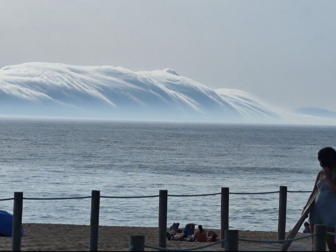
In a statement, the IPMA indicates that the 'rolling clouds' formed at sea around 3:30 pm, having approached the west coast of mainland Portugal between Peniche and Póvoa de Varzim between 5pm and 6pm.
According to the IPMA, rolling clouds are “relatively rare” and were only included in the World Meteorological Organization's cloud atlas in the last revision, in 2017.
Bathers were surprised by a cloud that looked like a giant wave, accompanied by strong winds, due to the difference in temperature between the land and sea surfaces.
The clouds, which belong to the species 'volutus' (in Latin), are tubular or roll-shaped, form around a horizontal axis and are typically associated with the cloud genera altocumulus (sheets or layers of white or grey clouds) or stratocumulus (low clouds with rounded and cylindrical masses).
Using an image of the Portuguese coast obtained by the 3rd generation Meteosat satellite, the IPMA reported the “existence of a disturbed flow, with waves within the atmosphere, known as internal gravity waves, particularly in a low layer of the atmosphere”.
The heatwave that hit the continent over the weekend caused fires on Sunday, but also unstable meteorological phenomena, such as heavy rain and strong winds, thunderstorms and hail.
Due to the heatwave, IPMA has placed seven districts on the mainland on red alert between Sunday and Tuesday: Lisbon, Setúbal, Santarém, Évora, Beja, Castelo Branco and Portalegre.
The remaining districts will be on orange (the second most serious) and yellow alerts, varying from day to day.




Very vague. Please find a more extensive explanation:
By Claes Parflo from Algarve on 01 Jul 2025, 09:56